Variable Trade Area
Geoscape® PrecisionPoint™ Variable Trade Area Model (VTAM) estimates the primary trade area (PTA) radius that accounts for 75% to 85% of a retail location’s sales.
– Key inputs include
• distances to population groups and their size,
• population densities,
• type of retailer (e.g., home improvement center, supermarket),
• type of retail location (e.g., neighborhood, community, or regional shopping center, CBD, free-standing)
VTAM provides a rapid and realistically-accurate measurement of trade area consumer buying potential in the absence of actual buyer data.
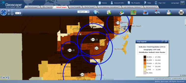
Retail Target, will generate variable primary trade areas for the sites plotted based on the reach and retailer type selected.
Click Trade Area Settings tab
Under Trade Area Model select Advanced
Select the appropriate Trade Area Type.
Select the Reach, Neighborhood, Community, or Regional, that best describes the span that retail sites being analyzed are targeting.
From the Retailer Type drop down list select the option that best describes the type of stores being analyzed. Note that available options vary depending on the Reach selected.
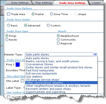
Click Update Map. If analyzing multiple site most likely the defined trade areas will have different sizes.
In the submenu, click
 and then select Map
Report to obtain the analysis of the trade areas for the
indicator selected in the Data Settings tab. The report
will include the exact radius that was defined for each site in
the Range column.
and then select Map
Report to obtain the analysis of the trade areas for the
indicator selected in the Data Settings tab. The report
will include the exact radius that was defined for each site in
the Range column.To generate a report that includes multiple indicators select Advanced Report.