Isolate Geography
The isolate Geography allows you to thematically isolate multiple entities for the level of geography selected. You may also then highlight any lower level geographies within the isolated areas. All other geographies outside the isolated zones are not shaded in the thematic colors.
On the Data Settings tab under Isolate Geography select the Isolate check box. The Isolate Geography popup window displays. with the Type automatically to match the Geography selected in the Data Settings tab and lists all the geographies currently in view on the map.
From the Type drop down list select desired geography to isolate. The options available depend on the zoom level selected and the data you’ve licensed. You cannot isolate a lower level geography than the one currently selected on the Data Settings tab.
Geography
Minimum Zoom Level
State
4
DMA
4
Congressional District
5
Metro Area
5
County
5
ZIP Code
8
Populated ZIP Code
8
Census Tract
10
Block Group
13
Block
14
Custom Geography (if defined)
all
From the lists of the geographies currently in view on the map, select the check box next to each geography you want to isolate.
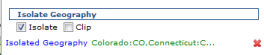
Click Apply. The isolate geography popup window closes a list of the Isolated Geography displays beneath the Isolate check box
Isolated Geography list displays beneath the Isolate check box.

Click Update Map to refresh the map.
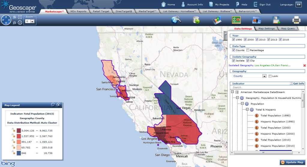
Some geographies extend beyond the contours of the isolated entity. The Clip option allows you to visually trim the geographies within the isolated region. For example some Designated Market Areas (DMA)® extend beyond state boundaries and some counties extend beyond DMA boundary.
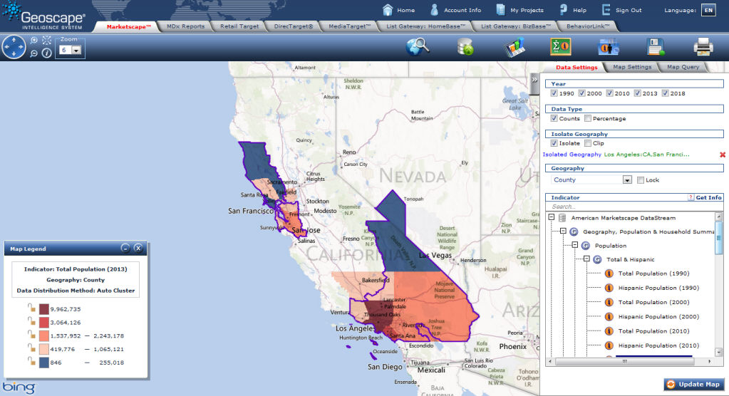
Below is an example of the Los Angeles and San Francisco DMA isolated with county selected as the level of geography for analysis. Notice how a couple of counties extend beyond the DMA boundary (purple).
Some geographies extend beyond the contours of the isolated entity. The Clip option allows you to visually trim the geographies within the isolated region. For example some Designated Market Areas (DMA)® extend beyond state boundaries and some counties extend beyond DMA boundary.
On the Data Settings tab under Isolate Geography select the Isolate check box. The Isolate Geography popup window displays with the Type automatically to match the Geography selected in the Data Settings tab and lists all the geographies currently in view on the map.
From the Type drop down list select desired geography to isolate.
Select the check box next to each geography you want to isolate.
Click Apply
Select Clip check box
Click Update Map to refresh the map.
Delete Isolated Geographies
To disable isolation deselect the Isolate check box.
To
remove the list of selected geographies click the ![]()
Edit Isolated Geographies
To edit which geographies are isolated:
Click Isolated Geography. The Isolate Geography popup window displays with the Type drop down list automatically populated with same geography level selected if available at the current zoom level selected.
From the Type drop down list select desired geography to isolate. The options available depend on the zoom level selected and the data you’ve licensed. You cannot isolate a lower level geography than the one currently selected on the Data Settings tab.
Geography
Minimum Zoom Level
State
4
DMA
4
Congressional District
5
Metro Area
5
County
5
ZIP Code
8
Populated ZIP Code
8
Census Tract
10
Block Group
13
Block
14
From the lists of the geographies currently in view on the map, select the check box next to each geography you want to isolate.
Click Apply. The isolate geography popup window closes a list of the Isolated Geography displays beneath the Isolate check box
Isolated Geography list displays beneath the Isolate check box.